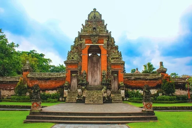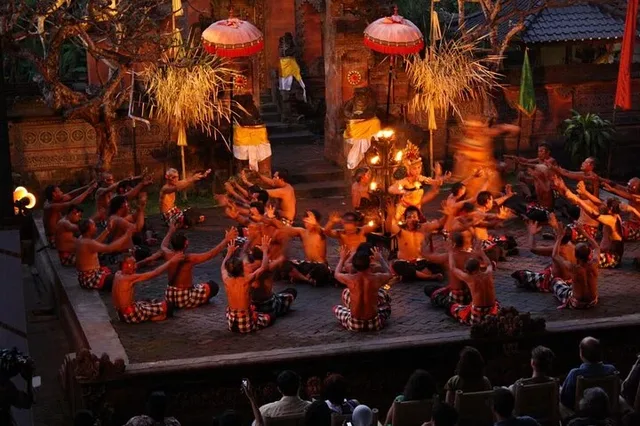
Gunung Kawi does not reveal itself from the road. First come the stone steps, rice terraces and thick vegetation; only at the bottom of the Pakerisan River valley do its monumental cliff shrines appear. Their scale is dramatic, but the place is more than an archaeological curiosity. It remains a sacred landscape shaped by royal memory, water and worship.
This guide separates established history from local legend, explains what the ten carvings represent, and covers the practical details needed to visit respectfully.
Gunung Kawi Temple at a glance
Gunung Kawi entrance fee and what to budget
Officially published adult admission.
Officially published admission; identification may be requested.
Per adult for admission, possible tariff variation, parking and small expenses.
- Sarong and sash: required; the official visitor information indicates appropriate temple dress, but confirm whether the loan is included when purchasing your ticket.
- Children: the current official page does not publish a clearly separated child tariff, so ask at the ticket counter rather than relying on older online prices.
- Parking: charged separately and may depend on vehicle type.
- Payment: carry Indonesian rupiah. Do not depend on card or mobile payment being available.
A royal sanctuary carved into the valley

Gunung Kawi is generally dated to the 11th century and associated with the Warmadewa dynasty, particularly the reign of King Anak Wungsu. The official Gianyar tourism account connects the site with King Udayana, his sons Marakata and Anak Wungsu, and the religious community recorded around the Pakerisan River.
An inscription often rendered as Haji Lumah ing Jalu links one monument with a ruler enshrined at Jalu. Another, Rwa Nak Ira, has been interpreted as “his two sons.” These clues support the royal association, but scholars continue to debate exactly whom every monument commemorates.
Memorial shrines—not ordinary tomb chambers
Gunung Kawi is frequently described as a royal tomb complex. That shorthand is misleading if it suggests bodies were placed inside the carvings. The rock-cut candi are better understood as commemorative or deification monuments connected with royal ancestors and worship. They are solid façades rather than buildings with burial rooms.
What remains uncertain
The broad period and royal context are supported, but not every dedication is settled beyond doubt. The original text’s suggestion that Gunung Kawi may have been an astronomical site is not supported strongly enough to present as history. Its ritual, memorial and monastic functions provide a much firmer interpretation.
The legend of Kebo Iwa
Local folklore gives the valley a more spectacular origin. Kebo Iwa, a giant and powerful figure in Balinese legend, is said to have cut the monuments into the cliff with his fingernails in a single night. The story is not an archaeological explanation, but it expresses how extraordinary the carvings appeared to later generations.
History and legend do not need to compete here. One explains the political and religious setting; the other records how the site lives in cultural memory.
What to see inside the complex
The ten rock-cut candi
Ten monumental façades occupy several groups around the river valley. Five stand together on one side of the Pakerisan, four face them across the water, and one lies farther south. Each is carved within a deep niche that frames and protects the shrine-like form.

The Pakerisan River and sacred water

The Pakerisan is not simply scenery dividing the monuments. Water carries ritual importance in Balinese Hindu practice, and holy water from the area continues to be used ceremonially. South of the principal monuments, the meeting of the Pakerisan and Bulan rivers is regarded locally as a place of purification.
Hermitages and meditation spaces
Rock-cut chambers and niches elsewhere in the complex point to a religious community living or meditating near the royal monuments. This helps explain why Gunung Kawi is understood not only as an ancestral sanctuary but also as a place of spiritual training.
The descent through rice terraces
The approach is part of the experience. Steps descend past irrigation channels, small stalls and terraced fields before reaching the cooler valley floor. Save some energy: the climb back is more demanding than the walk down, especially in midday humidity or after rain.

How to plan your visit
Best time to arrive
Morning generally offers cooler conditions and more time to explore without watching the clock. Late afternoon can be pleasant, but enter early enough to descend, explore and climb out before closing.
What to wear and carry
Wear secure walking shoes, breathable clothing, and the required sarong and sash. Carry drinking water, sun or rain protection, and enough rupiah for admission and small expenses.
Mobility and accessibility
The long staircase, uneven and sometimes wet surfaces, and steep return climb make the main complex difficult for wheelchairs and some visitors with limited mobility. Ask locally about current assistance, but do not assume step-free access.
Temple etiquette
Keep voices low, do not climb on monuments, avoid crossing in front of worshippers, and never move offerings for a photograph. Ceremonies take priority and may temporarily limit access.
Do not confuse it with Gunung Kawi Sebatu
Two attractions share a similar name. This article covers Candi Gunung Kawi in Tampaksiring, the valley with 11th-century cliff monuments. Pura Gunung Kawi Sebatu is a separate water-temple complex several kilometres away. Check the map pin before leaving.
Map, distances and how to get there
Gunung Kawi is in Tampaksiring, roughly 18 kilometres northeast of central Ubud. The drive commonly takes around 30–40 minutes in lighter traffic but can be considerably longer. There is no simple direct public-transport connection for most visitors, so arrange a driver, tour, taxi or suitable private transport and confirm the return plan before descending.
| Starting area | Approx. road distance | Planning time |
|---|---|---|
| Central Ubud | About 18 km | 30–50 minutes |
| Tegallalang | About 11–15 km | 25–40 minutes |
| Kintamani | About 25 km | 45–65 minutes |
| Sanur | About 38–42 km | 1 hr 15 min–1 hr 45 min |
| Kuta / Seminyak | About 45–50 km | 1 hr 30 min–2 hr 15 min |
| Bali Airport (DPS) | About 50 km | 1 hr 45 min–2 hr 30 min |
Distances and driving times are planning estimates, not live navigation. Bali traffic, ceremonies, rain and road works can change them considerably.
Nearby attractions that fit the same route
An active water temple known for sacred springs and purification rituals. Visit as a place of worship, not simply as a bathing attraction.
A wider rice-terrace area with several entrances and viewpoints. Choose one rather than trying to stop at every roadside attraction.
Continue north for views of Mount Batur and Lake Batur. Cloud and rain can affect visibility, especially later in the day.
Another archaeological and sacred complex, known for its carved cave entrance, bathing pools and layered Hindu-Buddhist history.
Puri Saraswati and central Ubud provide a contrasting view of living temple architecture and the region’s artistic identity.
Two sensible ways to combine the area
Allow enough time for the steps at Gunung Kawi, then continue to the nearby water temple. This is the easier combination if you want a slower morning.
Connect Ubud’s living temple architecture with Tampaksiring’s archaeology and the volcanic landscape around Mount Batur. Start early and keep the number of stops realistic.
Visit with a lighter footprint
- Carry a refillable bottle and take all waste back out of the valley.
- Remain on established paths to protect terraces, irrigation edges and vegetation.
- Do not touch, sit on or climb the sandstone monuments.
- Ask before closely photographing worshippers or ceremonial activity.
- Support local stalls thoughtfully without treating sacred dress or offerings as photo props.
- Avoid loud audio, drones and staged images that disrupt the atmosphere.
Frequently asked questions
Is Gunung Kawi a cemetery?
It is commonly called a royal tomb complex, but the cliff monuments are solid commemorative shrines rather than chambers containing human remains.
How many shrines are at Gunung Kawi?
The complex contains ten monumental rock-cut candi arranged in groups around the Pakerisan River valley.
How difficult is the walk?
Visitors descend roughly 300–400 steps. The return climb can be strenuous in heat or rain, and surfaces may be slippery.
How long should I spend there?
Allow around 1–2 hours for the descent, monuments, river setting and climb back. Add time if you prefer a slower pace.
Can children visit?
Yes, but adults should supervise children on steep or wet steps and near the river. A stroller is not practical for the main descent.
See Gunung Kawi in its Central Bali context
Gunung Kawi makes more sense when it is not treated as an isolated photo stop. Ubud’s temple architecture, the royal and sacred landscapes of Tampaksiring, and the volcanic geography around Kintamani reveal different layers of Central Bali in a single route.
Explore Central Bali in one considered journey
The Highlight of Central Bali experience connects Gunung Kawi with Puri Saraswati, Kintamani and the lakeside hot springs at Toya Devasya. Check the current itinerary, inclusions and availability before choosing a date.